
Mount Semeru wildfire extinguished after burning 3,072 hectares in East Java
Firefighters have successfully contained a major wildfire on Mount Semeru that burned over 3,000 hectares of Bromo Tengger Semeru National Park, with the popular Ranu Kumbolo hiking area suffering the heaviest damage.
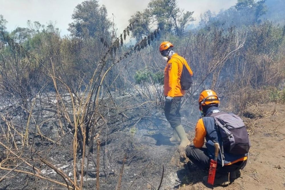
Mount Semeru wildfire extinguished after burning 3,072 hectares in East Java
A massive wildfire on Mount Semeru, Java's highest peak at 3,676 meters above sea level, has been fully extinguished after consuming 3,072 hectares of forest and land within Bromo Tengger Semeru National Park, authorities confirmed on September 5.
Isnugroho, head of the Lumajang District Disaster Mitigation Agency, declared the containment operation complete after joint ground patrols and helicopter water-bombing missions detected no remaining hotspots. Ongoing monitoring responsibilities have been transferred to the National Park Management Section Region III Ranupani, which oversees the affected areas within the 50,276-hectare national park.
The burned area represents approximately six percent of the total park territory, making this one of the most significant wildfires in the volcanic region. Field officers continue calculating the full extent of damage through September 5, according to the Bromo Tengger Semeru National Park Center.
Hardest-hit areas and popular hiking destinations
The fire spread across multiple sectors of the national park. The Dingklik Block, including Pacis Bincil, Kedaluh, and Penanjakan areas, lost 211.24 hectares. The Bantengan, Watangan, Jantur, and B29 sectors saw 881.78 hectares consumed by flames.
The most severe damage occurred in and around Ranu Kumbolo, a volcanic lake situated at 2,400 meters above sea level that serves as a popular camping site and water source for hikers on the Mount Semeru trail. This beloved trekking destination and surrounding areas suffered losses totaling 1,887 hectares. Officials are still calculating affected land in Krepelan Block near Ranupani Village, where total damage remains undetermined.
Multi-agency firefighting response
The firefighting operation mobilized extensive resources from multiple agencies, including the Bromo Tengger Semeru National Park Center, Manggala Agni specialized forest fire teams, provincial and district disaster mitigation agencies, local police, military commands, community groups, and the Ministry of Forestry.
A standby team from the Lumajang District Disaster Mitigation Agency deployed to the wetting area in Krepelan Block toward Ranupani using jet shooters and blowers. The agency's Rapid Response Team patrolled the Mount Semeru hiking route up to Post 2 to monitor for new hotspots, reporting clear conditions throughout the monitored areas.
Recent rainfall in parts of Lumajang District, including Pronojiwo Sub-district and areas surrounding Lumajang city, provided additional natural assistance in containing the fire.
Broader context of Indonesia's fire crisis
The Mount Semeru wildfire occurred against the backdrop of a severe nationwide fire season. As of August 18, Indonesia's Ministry of Forestry reported that 202,000 hectares of forests and land had burned across the country in 2026, representing a 110 percent increase compared to the same period in 2023. East Java Province recorded 20,957 hectares burned from forest and land fires in 2024, ranking sixth among Indonesian provinces for fire-affected area.
The firefighting efforts faced additional challenges due to Mount Semeru's status as one of Indonesia's most active volcanoes. The mountain has maintained near-continuous volcanic eruption activity since 1967, with regular explosive activity every 20-30 minutes producing ash plumes. The volcano erupted 2,239 times during 2024, making it the second most frequently erupting volcano in Indonesia that year.
The area also carries memories of recent disaster. In December 2021, a major eruption of Mount Semeru killed at least 51 people and displaced more than 10,000 residents, marking one of the deadliest volcanic events in recent Indonesian history.