
Flores earthquake death toll holds at 111 as nearly 9,000 aftershocks recorded
The National Disaster Mitigation Agency reports 111 fatalities from the magnitude 7.7 earthquake that struck Flores Island on August 15, while seismologists record 8,794 aftershocks and predict continued seismic activity for up to four weeks.
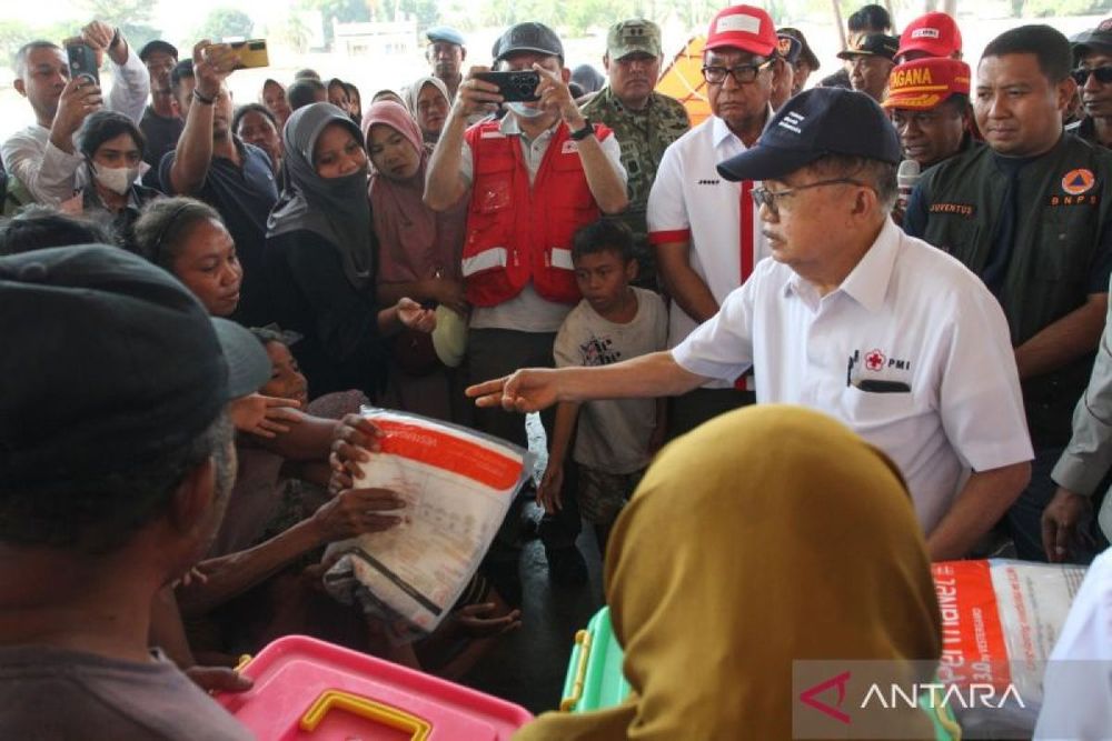
NTT quake death toll at 111 as aftershocks reach 8,794: BNPB
The death toll from the devastating magnitude 7.7 earthquake that struck Flores Island, East Nusa Tenggara, remained at 111 as of Friday afternoon, while the region continues to experience thousands of aftershocks two weeks after the initial disaster, according to the National Disaster Mitigation Agency (BNPB).
Berton SP Panjaitan, Acting Head of the BNPB Disaster Data, Information and Communication Center, told reporters at a Friday press conference that the Meteorology, Climatology, and Geophysics Agency (BMKG) has recorded 8,794 aftershocks since the main earthquake occurred at 5:58 AM local time on August 15. The epicenter was located approximately 68 kilometers north-northwest of Ende city at a depth of 10 kilometers.
The aftershocks have ranged in magnitude from 1.0 to a peak of 6.2, with 152 strong enough to be felt by residents across the affected areas. Seismologists predict that seismic activity will persist for another three to four weeks as the region adjusts to the tectonic shift.
Geographic distribution of casualties
Manggarai District recorded the highest number of fatalities at 45, followed by East Manggarai with 38 deaths and Nagekeo with 13. The casualties disproportionately affected women, who accounted for 56.4 percent of the victims, while men represented 43.6 percent. Elderly residents comprised the largest age group among fatalities at 45 percent, followed by adults at 37 percent.
Flores Island, the largest island in East Nusa Tenggara Province, spans 14,250 square kilometers and is home to approximately 2.01 million people. The earthquake struck a region that lies along the Flores Thrust fault system, a hazardous tectonic feature extending from eastern Java past the Lesser Sunda Islands, including Bali, Lombok, Sumbawa, and Flores.
Indonesia's seismic vulnerability
The disaster underscores Indonesia's position as one of the most seismically active countries on Earth. The archipelago sits at the intersection of the Indo-Australian, Eurasian, and Pacific tectonic plates within the Pacific Ring of Fire, a 40,000-kilometer horseshoe-shaped zone that accounts for approximately 90 percent of the world's earthquakes. Indonesia records over 7,000 earthquakes annually and maintains more than 130 active volcanoes.
The region has experienced major seismic events before. In December 1992, a magnitude 7.5 earthquake struck the Flores area, causing between 2,080 and 2,500 deaths and generating a tsunami up to 26 meters high, demonstrating the long-term seismic hazard in this zone.
The August 15 earthquake also triggered a tsunami, with a maximum wave height of 1.61 meters recorded at Reok in Manggarai Regency, while Labuan Bajo experienced a 30-centimeter wave.
Evacuation shelters and relief efforts
The number of residents staying at evacuation shelters has begun to decline, according to Panjaitan. In Sikka District alone, 712 evacuees have returned home, bringing the total number of evacuees in East Nusa Tenggara to 175,909.
The BNPB encouraged evacuees who remain hesitant or afraid to return home to utilize centralized evacuation shelters, where they can access logistical supplies, clean water, sanitation facilities, public kitchens, and basic health services.
Despite the widespread devastation in some areas, tourism activities in Labuan Bajo, a major gateway to Komodo National Park, resumed normal operations shortly after the earthquake. The port authority recorded 308 tourist boats departing with 3,651 passengers on August 16, demonstrating the resilience of some economic sectors in the region.
BMKG, Indonesia's non-departmental government agency responsible for monitoring meteorology, climatology, and geophysics, operates the Indonesia Tsunami Early Warning System, which can issue tsunami warnings within five minutes of earthquake occurrence. The agency continues to monitor seismic activity across the affected areas as relief efforts proceed.