
Indonesia strengthens maritime navigation partnership with IALA to address rising safety challenges
Indonesia's Transportation Ministry expands cooperation with the International Association of Marine Aids to Navigation and Lighthouse Authorities through 2028, focusing on vessel traffic systems and risk assessment as maritime incidents increase across the archipelago.

Indonesia strengthens maritime navigation partnership with IALA to address rising safety challenges
Indonesia's Transportation Ministry is expanding its partnership with the International Association of Marine Aids to Navigation and Lighthouse Authorities (IALA) to enhance maritime safety across the world's largest archipelagic state, which comprises 17,508 islands with approximately 108,000 kilometers of coastline and a sea area covering 6.9 million square kilometers.
The cooperation comes as Indonesia's Search and Rescue Agency reported 601 maritime incidents between January and August 2026 requiring deployment, a sharp increase from 450 incidents for the entire year 2025. Between 2003 and 2025, the National Transportation Safety Committee recorded 250 maritime accidents resulting in 2,616 casualties, including 1,925 fatalities and 691 injuries.
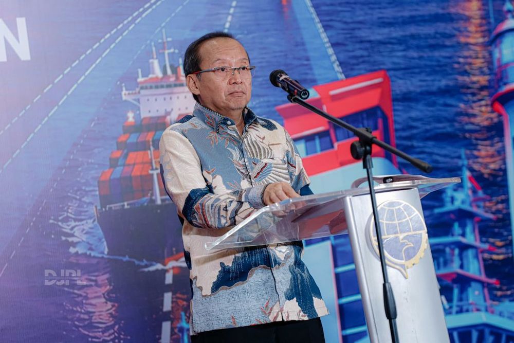
"Navigation is a vital factor in ensuring maritime safety," said Hernadi Tri Cahyanto, the ministry's director of navigation, speaking at a Marine Navigation Safety Seminar in Jakarta on Tuesday. The three-day event, running from October 5 to 7, features experts from IALA sharing global expertise on improving navigation reliability under national and international standards.
IALA, founded in 1957, brings together representatives of aids to navigation services from about 80 countries for technical coordination and information sharing. The organization officially transitioned from a Non-Governmental Organization to an Intergovernmental Organization on August 22, 2024, based on a Convention ratified or acceded to by 34 States, elevating its international standing.
Comprehensive navigation system improvements
Hernadi emphasized that strengthening the navigation system requires providing and upgrading Aids to Navigation (AtoN) while optimizing Vessel Traffic Services (VTS). These shore-based systems, recognized internationally under SOLAS Chapter V Regulation 12, monitor vessel movements using VHF communication, AIS, radar and camera technologies to prevent collisions, groundings and other maritime incidents.
The efforts also encompass shipping-lane management and development, along with regular updates to nautical charts to support maritime safety, security and efficient operations. "We must ensure all navigation systems and services operate optimally, reliably and comply with national and international standards," Hernadi said.
The director praised IALA's support under a 2024-2025 partnership that included technical missions across navigation districts, recommendations on AtoN, VTS and shipping lanes, and personnel training through the IALA Academy.
Extended partnership and risk assessment focus
The cooperation will continue through 2026-2028, including a Risk Assessment Workshop for the Surabaya West Access Channel using the Simplified IALA Risk Assessment (SIRA) Method. This strategic shipping route in the Madura Strait was dredged in 2014 from 8 meters to 13 meters depth with 150 meters width to accommodate larger vessels accessing Surabaya's Tanjung Perak Port, Indonesia's second-busiest port.
The channel requires periodic maintenance dredging due to high sedimentation rates from multiple rivers in East Java, with future plans to widen it to 200 meters and deepen it to 16 meters. The workshop will pilot risk assessments supporting the planning, implementation and evaluation of maritime safety measures involving shipping lanes, AtoN, VTS and nautical charts.
The urgency of these safety improvements is underscored by regional shipping data showing that South China, Indochina, Indonesia and the Philippines experienced the largest number of shipping losses globally from 2015 through 2024 with 169 total losses. Indonesia also faces broader maritime security challenges, including illegal, unreported and unregulated fishing, which caused losses exceeding $800 million between 2020 and 2025.
Zero-accident policy and shared responsibility
Hernadi stressed that safety must remain a priority for every vessel and represents a shared responsibility among transport workers and the maritime community. The ministry is urging operators, maritime stakeholders, academics and other parties to recognize navigation's role in supporting its zero-accident policy.
The director emphasized that AtoN must remain fully operational and compliant, while VTS must provide information, manage traffic, respond to distress situations and communicate proactively with vessels. Nautical charts, including electronic navigation charts, must be updated regularly, while violations that could endanger lives, cargo or the environment must be reported.
Achieving these objectives requires closer cooperation among the ministry's Directorate General of Sea Transportation, government agencies, regional administrations, businesses, shipping operators, pilotage providers and the wider maritime community, Hernadi concluded.